
 Your Account
 Email Sign-Up
 Buy Annual Pass


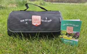
HOW FAR CAN YOU GO?
Hike, bike, run, or roll your way to meet your trail goal.
Log your completed challenge trails on the leaderboard and earn incentives along the way.
HOW IT WORKS
Join us for the Metroparks Trail Challenge! This is the perfect way to challenge yourself to get out to all 13 Metroparks and explore new trails. Each Metropark has a specific Challenge Trail or two for you to visit and earn incentives. You will visit the Challenge Trail in each park, find the Challenge Trail kiosk(s), take a selfie and then use the scannable QR code to upload it to the online leaderboard. Each Challenge Trail you visit earns you a badge on the online leaderboard – and incentives. You can visit all kiosks in a park for an extra challenge – 18 in all!
New this year, all parks will have a Challenge Trail with a kiosk that is accessible and pet-friendly so that everyone can participate. That means some parks will have more than one Challenge Trail to choose from on your visit to that park.
The cost to participate is $35 per person. Each registered participant will receive a custom Trail Challenge tumbler at the start of the challenge. But this year, you can also choose to register your pup to participate! For $10, register your furry trail buddy and they will get a custom Trail Challenge dog tag. Dogs will not earn additional incentives. You will see the option to add dog registration once you add your Trail Challenge to your cart. Look at the bottom of the screen for a button with a graphic of the dog tag itself. If you decide to add your dog on after you have already registered, you can click here.
The Trail Challenge will run from May 1 to October 31, but registration will close on October 24 to give you time to complete Challenge Trails and add them to the leaderboard.
Now for the best part … the incentives!
 With your paid registration you will receive a custom tumbler that you will have to pick up in-person from one of our park offices.
But you can earn more! When you visit the parks and hit a designated Challenge Trail, you’ll earn additional incentives. These trails have a specific kiosk along them, where you take a selfie to upload to the leaderboard. Each Challenge Trail you visit earns you a special badge on the online leaderboard.
For each Challenge Trail you visit, you will earn a custom sticker specific to that park that goes on your Trail Challenge tumbler. And if you earn all 13 badges (one from each park) you will also earn a 2026 Metroparks Annual Vehicle Pass so you can keep exploring the trails for another year. You can visit all kiosks in a park for an extra challenge – 18 in all (but no extra incentives are earned for this)!
Additional earned incentives (stickers and annual pass) are mailed out in November.


LEADERBOARD
Keep track of your Challenge Trail badges and see how you compare with others participating in the Metroparks Trail Challenge. The leaderboard will be updated immediately after submitting your Challenge Trail forms to display Challenge Trail badges earned for additional incentives.
NEW this year, you can sort the leaderboard alphabetically or search to easily find your display name and check your progress.
To upload Challenge Trail selfies, you will scan a QR code at each Challenge Trail Kiosk and submit a form while you’re standing at the kiosk. Remember, you will use the same phone number and display name each time you visit a Challenge Trail.
| Display Name | Challenge Trail Completed |
|---|---|
| ANoPay |
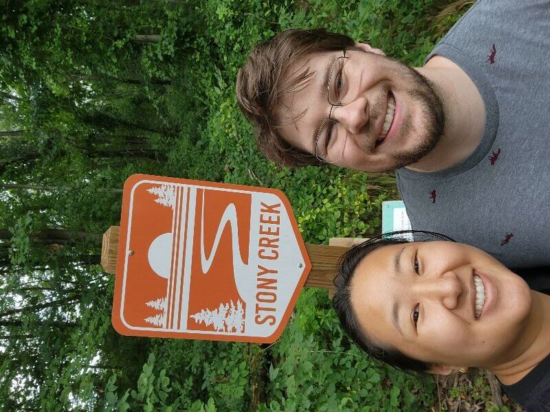
 Stony Creek Metropark Shelden Trails Stony Creek Metropark Shelden Trails |
| BradFelder |
 Hudson Mills Metropark Hudson Mills Metropark |
| BradFelder |
 Dexter-Huron Metropark Dexter-Huron Metropark |
| BradFelder |
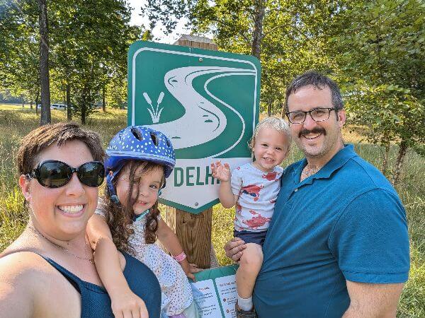
 Delhi Metropark Delhi Metropark |
| BradHCMA2 |
Delhi Metropark |
| KellyFelder |
 Kensington Metropark Kensington Metropark |
| MomontheMove |
Delhi Metropark |
| PaidPerson |
 Lake Erie Metropark Lake Erie Metropark |
HOW FAR CAN YOU GO?
Hike, bike, run or roll your way to meet your trail goal.
Log your miles on the leaderboard and earn incentives along the way.
Where do you find each park’s Challenge Trail?
New this year, all parks will have a Challenge Trail with a kiosk that is pet-friendly and accessible. That means some parks will have more than one Challenge Trail to choose from on your visit to that park. Below are the description of the locations of the Challenge Trails. Icons show which trail option is accessible or pet-friendly, be sure to chose the trail that works best for you. Below are icons that let you know what Challenge Trails are accessible, allow dogs or where dogs are not allowed.
 Accessible
 Dogs Allowed
 No Dogs Allowed
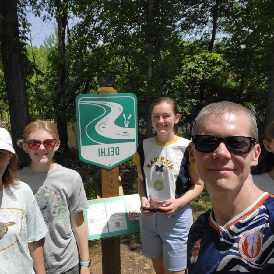
Delhi Metropark
As you follow the curve of the Huron River along the hike-bike trail just beyond the rapids and bridge, look for the kiosk near the comfort station. Enjoy the Huron River view, observe fish, turtles, snakes, frogs, mink, beavers and more. Click here to view park map, https://www.metroparks.com/delhi-metropark/#parkmaps.
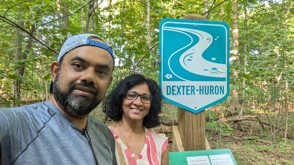
Dexter-Huron Metropark
Head east along the Border-to-Border Trail toward the Title IX Plaza to find the kiosk. Take a moment to investigate the Title IX Plaza. This project honors the impact of Title IX legislation on women’s sports in southeast Michigan. Click here to view park map, https://www.metroparks.com/dexter-huron-metropark/#parkmaps.
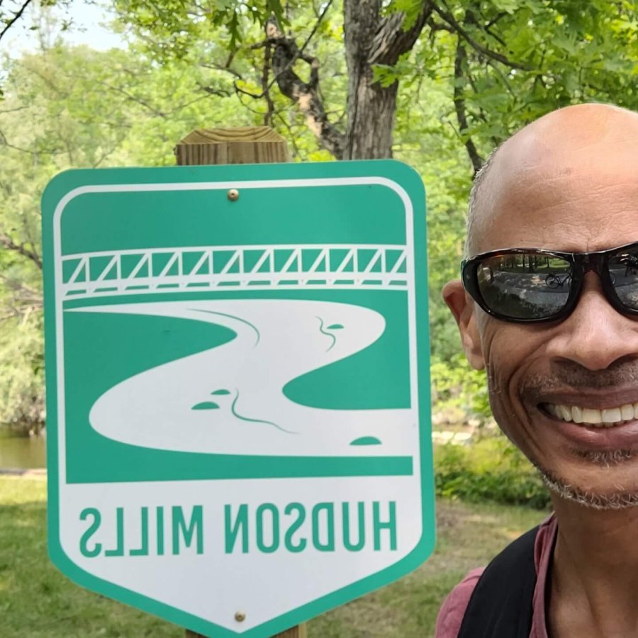
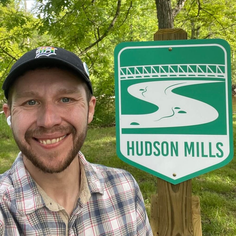
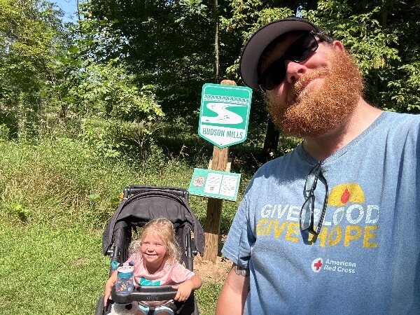
Hudson Mills Metropark
Along the Hike-Bike Trail near Rapids View, head towards canoe launch to find the kiosk. Hear the water from the Huron River as it tumbles over the rocks, creating homes for fish, turtles, frogs, snakes, beavers, and aquatic insects. Beavers are active in this area; they alter their environment by creating new habitats for plants and animals who rely on them. Click here to view park map, https://www.metroparks.com/hudson-mills-metropark/#parkmaps.
Huron Meadows Metropark
Look for the kiosk near the Maltby Lake Observation Deck accessible by ramp or steps. You can commonly find bluegill, sunfish and smallmouth bass while you enjoy the calm waters. You can also shore fish along the Huron River and Maltby Lake. Click here to view park map, https://www.metroparks.com/huron-meadows-metropark/#parkmaps.
Indian Springs Metropark
Challenge Trail Option 1:
Look for the kiosk located along the paved Hike-Bike Trail, near a large oak tree. Enjoy beautiful wildflower-dotted views of the restored prairie while listening to the relaxing sounds of grassland birds such as the Eastern Meadowlark. Rest under the canopy of the large oak tree, which supports hundreds of native animal species.
Challenge Trail Option 2:
From the Environmental Discovery Center follow the Lupine Loop Nature Trail through the rolling prairie hills to the overlook viewing area, to find the kiosk. This is one of the highest points in the park. Here you get a bird-eye view of the forested Great Huron Swamp, which is home to animals such as owls, coyotes and salamanders. From this swamp flows the headwaters of the Huron River, which flows over 100 miles, through many of your Metroparks, to Lake Erie.
Click here to view park map, https://www.metroparks.com/indian-springs-metropark/#parkmaps.
Kensington Metropark
Keep your eyes open for the kiosk as you explore the paved Hike-Bike Trail between the Boat Rental and the accessible playground at Maple Beach. Also be on the lookout for the birds, aquatic mammals, and many other creatures that thrive along the north shore of Kent Lake, which is a stretch of the Huron River that flows through Kensington Metropark. Click here to view park map, https://www.metroparks.com/kensington-metropark/#parkmaps.
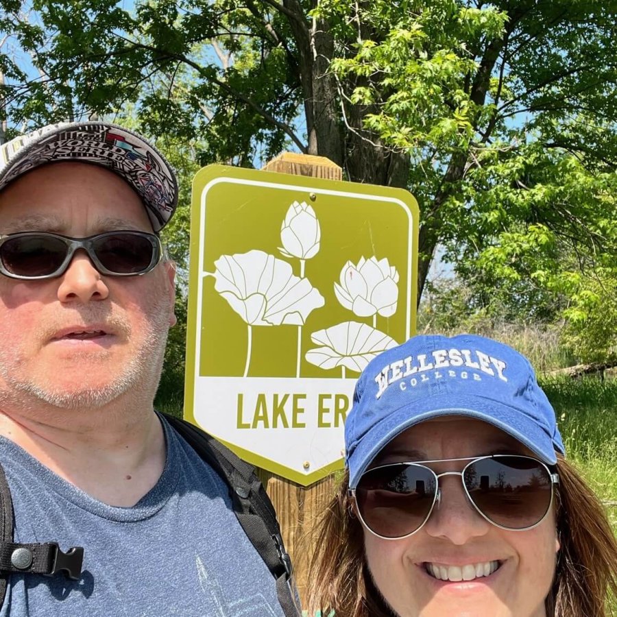
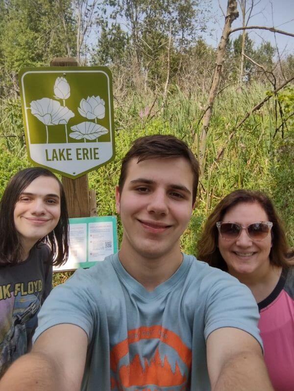
Lake Erie Metropark
Look for the kiosk along the newly repaved section of the Hike-Bike Trail between the Great Wave Area and Cove Point Picnic Area. The paved Hike-Bike Trail offers not just stunning views, but a chance to reflect on the rich history of the Detroit River and Lake Erie in this area. From the rich Indigenous history, to the War of 1812, Prohibition, or to modern day shipping, this region has played a prominent role in shaping the Downriver area. Click here to view park map, https://www.metroparks.com/lake-erie-metropark/#parkmaps.
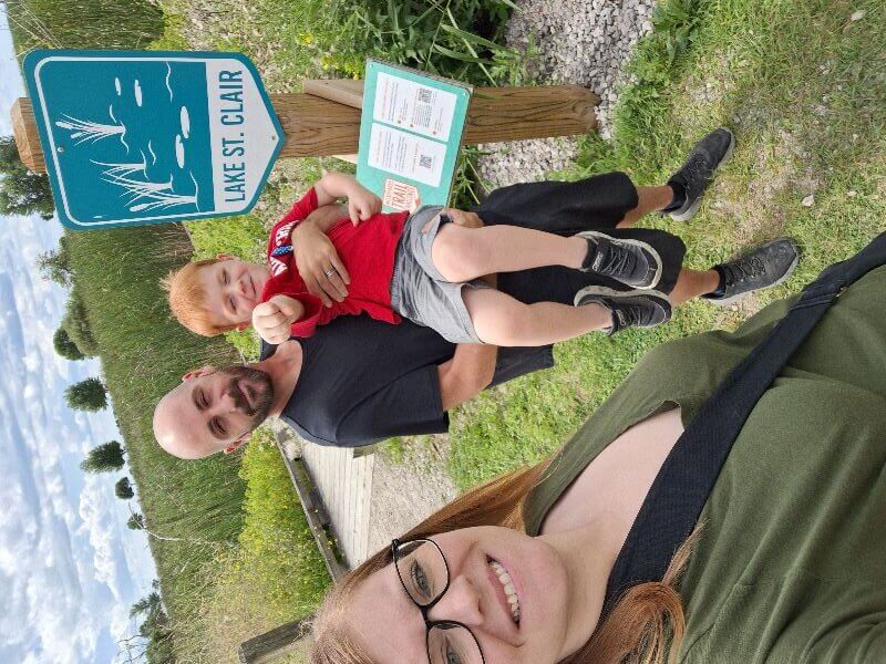
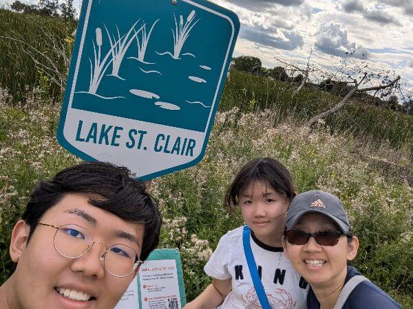
Lake St. Clair Metropark
Challenge Trail Option 1:
Along the Main Nature Trail located to the left of the Nature Center, the kiosk will be just beyond the first trail intersection. Be sure to stop at the nearby wing photo opps as well and swing into the Nature Center to see displays on wetlands, waterfowl, live animals and the historical use of the area by the French Voyageurs.
Challenge Trail Option 2:
From the main parking lot in front of the Thomas Welsh Activity Center, hop on the Hike-Bike Trail and follow Black Creek down toward the gazebo. The kiosk will be located past the gazebo as you continue the loop back towards the parking lot. If you listen carefully you will hear the buzz of pollinator insects and may even see a deer or fawn hiding in the tall grass. Each made possible by the addition of “Let it Grow Zones” throughout the park.
Click here to view park map, https://www.metroparks.com/lake-st-clair-metropark/#parkmaps.
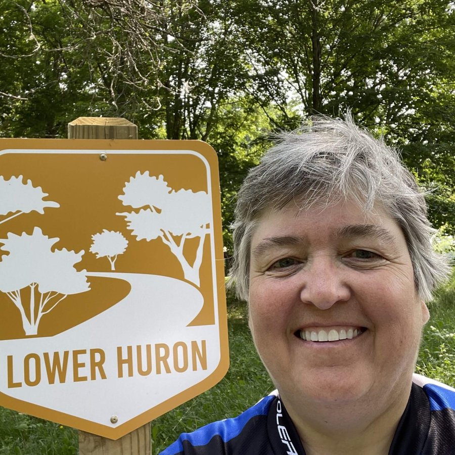
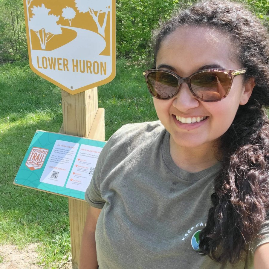
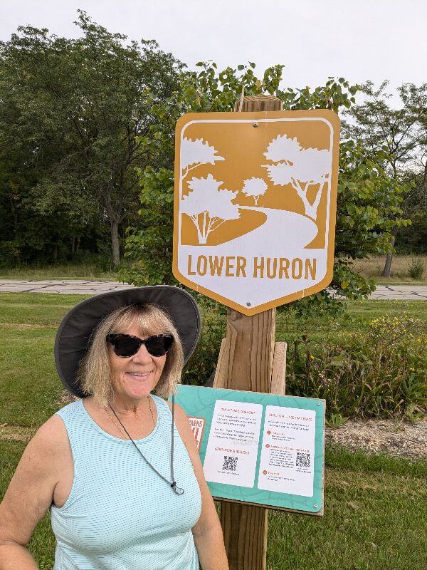
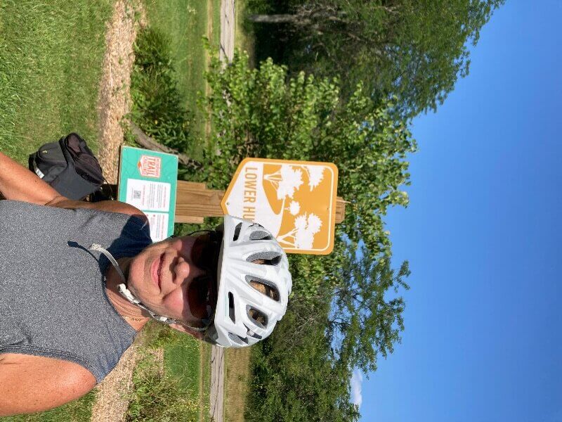
Lower Huron Metropark
Along the paved Hike-Bike Trail, look for the kiosk visible from the road north of the North Fishing Site. Part of the Iron-Belle Trail, which extends from the western-end of the Upper Peninsula to Belle Isle in Detroit, this trail allows users to view some of the most beautiful places in Michigan! Click here to view park map, https://www.metroparks.com/lower-huron-metropark/#parkmaps.
![]()
Oakwoods Metropark
Challenge Trail Option 1:
Outside of the Nature Center, look for the kiosk by the new accessible observation deck overlooking the backwaters of the Huron River. Here you can enjoy the sights and sounds of wetland plants, such as Cattails and Water Willow, and animals like Muskrat or Bald Eagles. Enjoy the serenity of this scenic overlook.
Challenge Trail Option 2:
Look for the kiosk along the paved Hike-Bike Trail east of the railroad tracks and the Horse Staging Area. Grasslands, like those in this area, are home to numerous plants and animals that are exclusive to this habitat. Look for birds such as Savannah Sparrows and Wilson’s Snipe, watch for Meadow Voles or Blue Racers going across the trail, or view wildflowers like Butterfly Weed or Queen Anne’s Lace. There is plenty to see in these fields!
Click here to view park map, https://www.metroparks.com/oakwoods-metropark/#parkmaps.
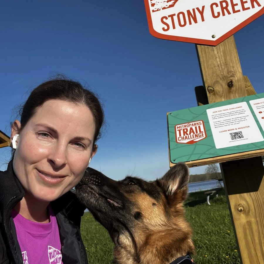
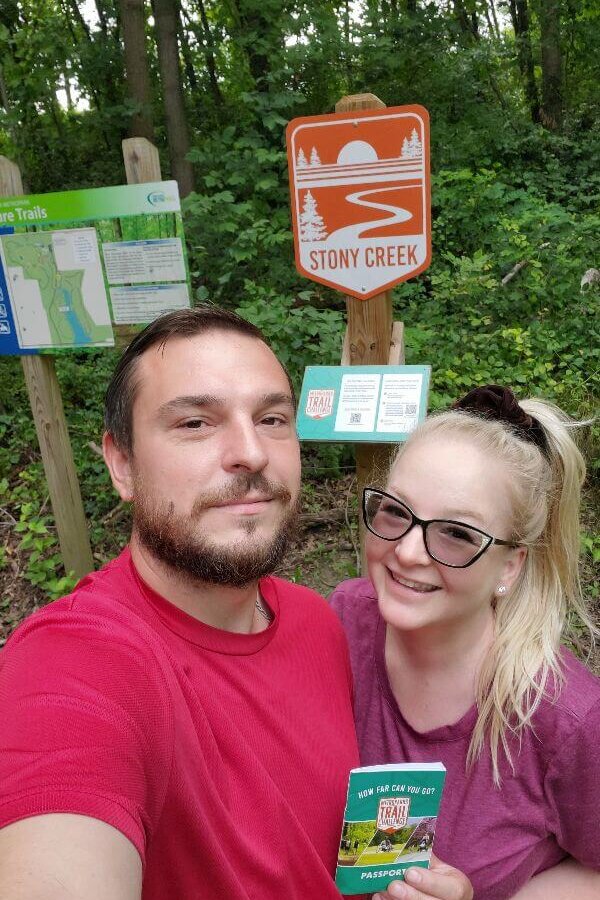
Stony Creek Metropark
Challenge Trail Option 1:
From the Eastwood Beach parking lot you will see the kiosk on the paved Hike-Bike Trail near the sign for the Fit Trail. The Fit Trail can be used for a quick run or walk along three different length trails, with exercise stations. The course provides a balanced routine of physical activity, offering 0.75-mile, 1-mile, and 1.75 miles of trail.
Challenge Trail Option 2:
Look for the kiosk at the Shelden Trails along the Rollercoaster Trail. Park in lot F of the West Branch picnic area. If mountain biking, ride the B-Line Trail from intersection 5 to 7 continuing on to intersection 8 located between the Rollercoaster and The Snake Trails. If hiking follow the two track from the parking lot to intersection 38 turning left to 7 and continuing to intersection 8. This is Mt. Shelden which may feel like the highest elevation in the park but to actually find that you will need to continue down the Rollercoaster Trail for another .5 mile to Fibber Mountain Peak.
Click here to view park map and Shelden Trails map, https://www.metroparks.com/stony-creek-metropark/#parkmaps.
Willow Metropark
From the Washago Area, you will head north on the paved Hike-Bike Trail, where you will find the kiosk along the Big Bend area of the river, where work has recently been done to improve and restore the area. Click here to vie park map, https://www.metroparks.com/willow-metropark/#parkmaps.
Wolcott Mill Metropark
Challenge Trail Option 1:
A short walk on the Historic Center paved trail from the parking lot towards the main buildings you will find the kiosk. From 1847 to 1967, our historic grist and feed mill helped support the everyday functioning of the farm communities. Today, this historic center remains much the same as it was 50 years ago, with some historic equipment still in operation – although at this time the inside of the building is closed.
Challenge Trail Option 2:
From the Historic Center parking lot, look for the kiosk about .75 of a mile on the rustic Settlers Trail along the North Branch of the Clinton River. You can continue the Settlers loop for a 2.5-mile hike traversing wooden boardwalks and steep embankments through wooded forest land passing by some early sites of Ray settlements that time and weather have worked hard to reclaim.
Click here to view park map, https://www.metroparks.com/wolcott-metropark/#parkmaps.
PHOTO GALLERY

FAQ
How long does the Trail Challenge last?
The Trail Challenge will run from May 1 to October 31, but registration will close on October 24 to give participants time to complete Challenge Trails before the program ends on October 31. Any Challenge Trails logged and selfies uploaded after October 31 will not be counted towards the challenge or the prize incentives.
What is the cost to participate & what do I get?
The cost to participate is $35 per person and you will receive a custom Trail Challenge tumbler. You receive your tumbler by visiting a Metroparks Office, during regular business hours, and showing your registration receipt on your phone or in hard copy.
Then you can earn additional incentives by completing Challenge Trails. For each park Challenge Trail you complete you will earn a custom sticker to add to your tumbler AND if you complete Challenge Trails in all 13 parks you will receive a 2026 Metroparks Annual Vehicle Pass so you can keep exploring the trails for another year.
If you earn any additional Challenge Trail prizes, these will be mailed to you in November. Remember they will be mailed to the address in your Metroparks account that you registered with originally.
What ages can participate?
All ages are welcome to register and participate. There are trails for everyone to enjoy.
And this year you can also sign up your dog! For $10, register your furry trail buddy and they will get a custom trail challenge dog tag. Dogs will not earn additional incentives. You will see the dog tag graphic button after you add the Trail Challenge to your cart, at the bottom of the screen.
Ok I'm registered, how do I get my tumbler and get started?
First, you need to set your leaderboard name. Check your email for your registration confirmation and instructions on how to set this before hitting the trails.
You receive your tumbler by visiting a Metroparks Office, during regular business hours, and showing your registration receipt on your phone or in hard copy. Then go out and hit that park’s challenge trail and you are on your way to great prizes. You can find the park office nearest to you by visiting our website. All our park office hours are listed in the information for each of our parks.
If you registered a dog, you will pick up your dog’s tag at the Metropark Office as well.
How do I log my Challenge Trails to the Leaderboard?
After you register to participate, you will receive an email receipt, there is an attachment to the receipt that provides the instructions on how to set your leaderboard name.
Each time you visit a Challenge Trail sign kiosk, you will be asked to scan a QR code at that kiosk and submit a leaderboard form while you’re standing at the kiosk. You will use the same display name each time you log Challenge Trails, and the leaderboard will automatically update. You MUST complete this Challenge Trail submission form while at the Challenge Trail kiosk.
How do I earn incentives?
Registered participants receive a custom tumbler and can earn additional incentives by visiting Challenge Trails and uploading selfies at the Trail Challenge kiosk on it. Challenge Trail selfies are uploaded through the online leaderboard submission form. It is accessed by scanning a QR code at each Challenge Trail sign kiosk. When the leaderboard updates the participant will have a badge on the leaderboard for each challenge trails selfie that is uploaded.
For each park Challenge Trail you complete you will earn a custom sticker to add to your tumbler AND if you complete Challenge Trails in all 13 parks you will receive a 2026 Metroparks Annual Vehicle Pass so you can keep exploring the trails for another year.
There are two Challenge Trail options at the following parks: Indian Springs, Lake St. Clair, Oakwoods, Stony Creek and Wolcott Mill Metroparks. So, there are 18 total Challenge Trails, but participants must complete a challenge trail in every park (13 parks) to earn the 2026 Annual Pass.
Challenge Trail incentives are mailed out in November for those that earned them.
How do I create multiple display names for my Metroparks Account Members who are participating.
For each registered participant from your Metroparks Account, you will complete the Display Name form using the phone number for them you indicated during registration and then create a new display name for that participant.
When you are at the kiosk to submit your selfie, scan the QR code and enter the phone number, a list of display names will populate that are associated with the phone number. Choose the correct username and complete the form. Each participant will need to upload their own selfie through the form to be added to the Leaderboard AND to earn the incentives.
Why do I have to enter my phone number each time I log Challenge Trails?
We use your phone number to make sure your leaderboard name is unique and that we are adding Challenge Trail badges to the correct registered participant on the leaderboard. This ensures you earn the correct incentives and prizes.
Where can I find the Metroparks trails?
You can look at all park maps by clicking here. Or you can stop by the park office for a hard copy map.
You can find Challenge Trails on the event webpage by clicking here. Staff within the park office can also help direct you.
Do I need a GPS watch/tracker or Strava? Will I need to show my watch or device for proof of being at a trail?
You can use one if you wish, but you don’t need one, and you can’t link it directly to our leaderboard at this time. However, you will be required to use a smart phone to take a selfie with the Challenge Trail signs, scan a QR code and submit those selfies while out on the trail in order to earn badges and incentives.
How do I turn location service on my cell phone?
You can visit the following link and follow the steps to turn on location services, https://www.lifewire.com/turn-on-mobile-location-services-4156232.
I can't see the form to log a Challenge Trail?
On your smart phone, make sure location services is turned on, then rescan the QR code on the sign or refresh the page.
What if I don't want to take a selfie?
You are certainly not required to. However, submitting a selfie to verify you were at a challenge trail is the ONLY way to earn the incentives. If you choose not to take this step, you will not be eligible to receive those prizes.
I registered my dog, now what?
Bring your receipt, electronically or hard copy to a Metroparks Office during regular business hours and you can pick up your custom dog tag.
Be sure to review the pet-friendly trail options for each park before your visit so you know which Challenge Trail to visit. You can find the list by clicking here.
Who can I contact if I have questions?
You can reach out to Hilary Simmet at hilary.simmet@metroparks.com or 810.494.6037.
 YOUR ACCOUNT